
BILLY MACLEOD MBE
AUTHOR - ROYAL ENGINEERS
An interactive campaign map tracking the 59th Field Company, Royal Engineers, from the advance to the Dyle Line through the retreat to Dunkirk.
Click any numbered marker to read that stage of the story. Use the category buttons above the map to filter by theme, browse the dated strip along the bottom to move through the timeline, and use the +/− controls (or scroll) to zoom in on a location.
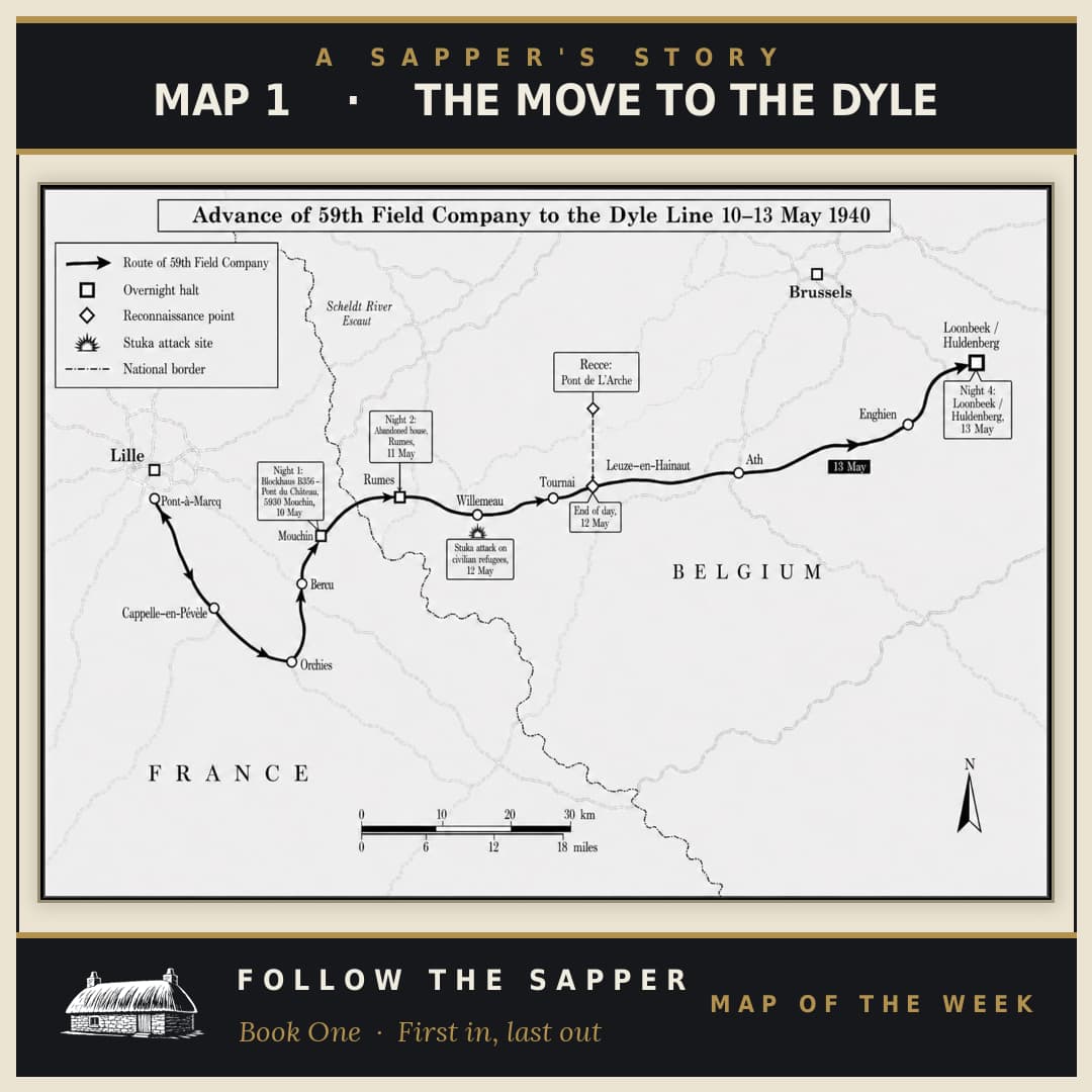
The Move to the Dyle
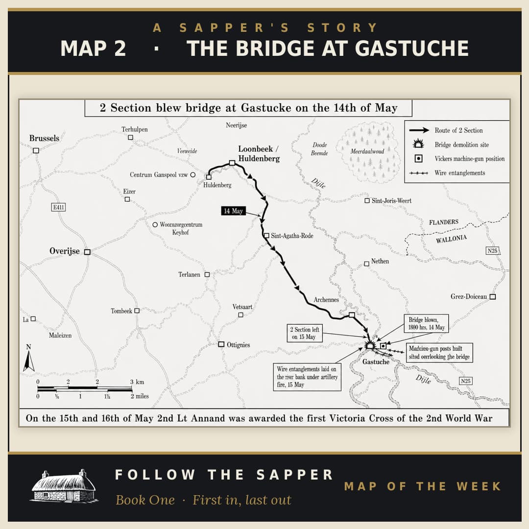
The Bridge at Gastuche
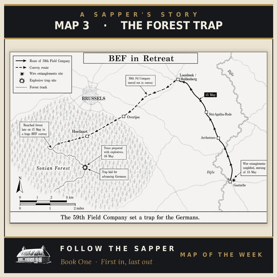
The Forest Map
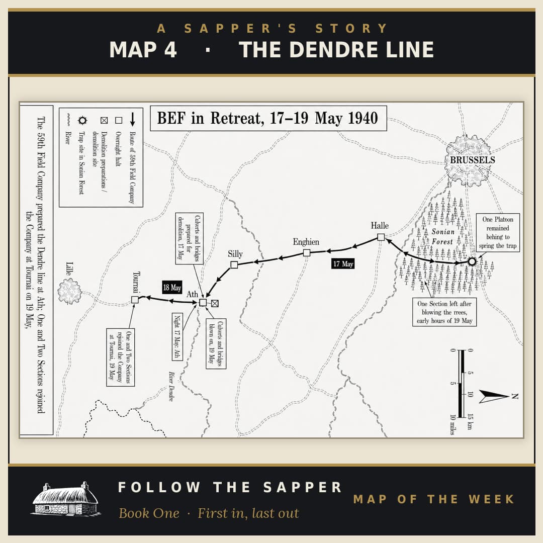
The Dendre Line
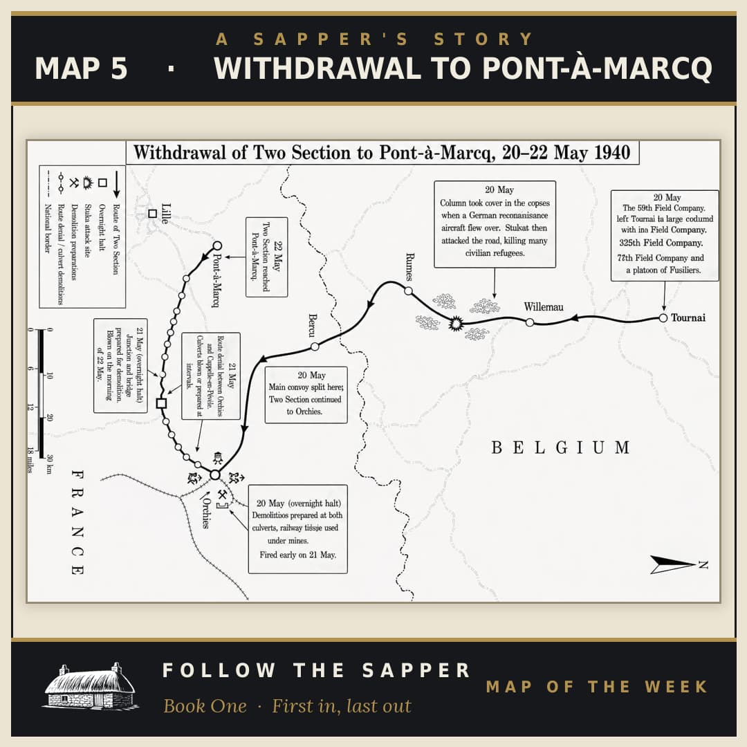
Withdrawal to Pont-à-Marcq
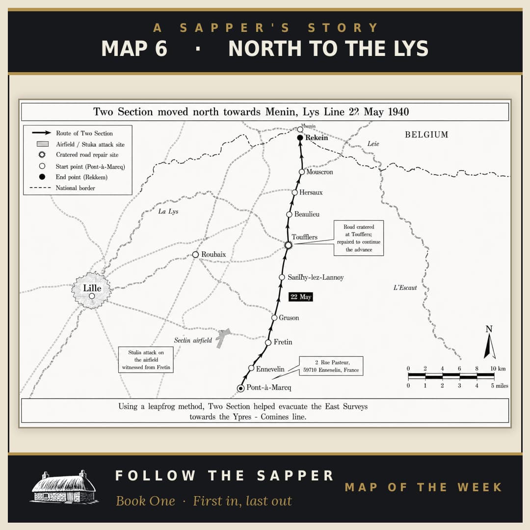
North to the Lys
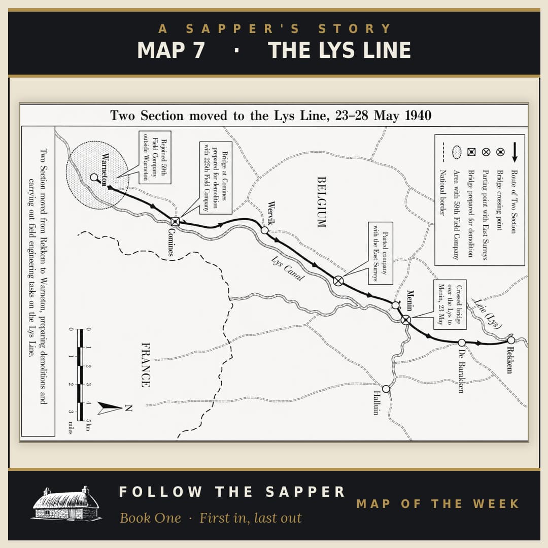
The Lys Line
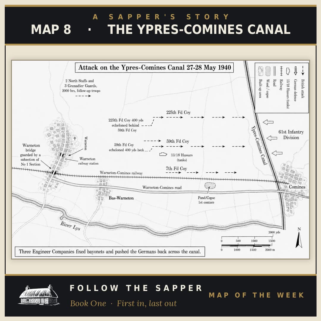
The Ypres-Comines Canal
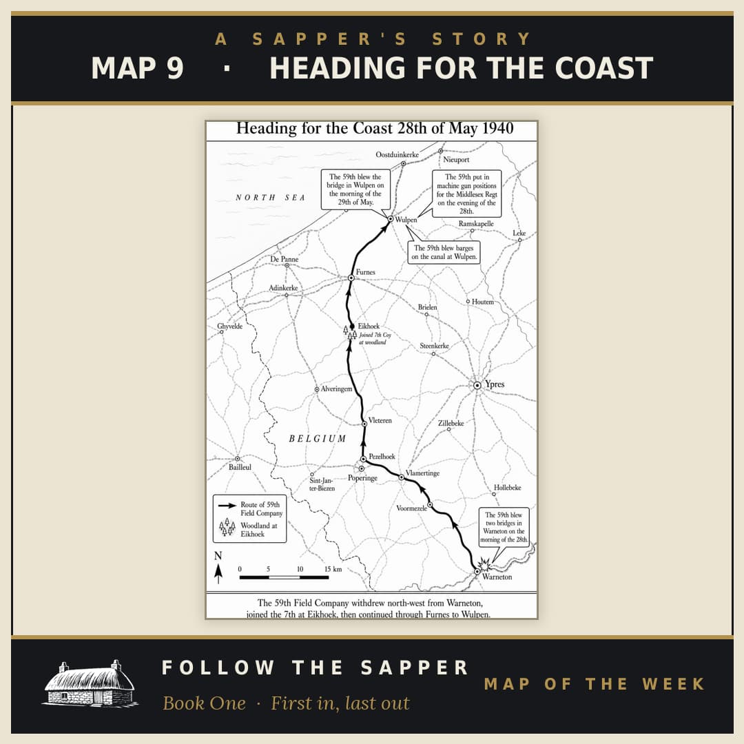
Heading for the Coast
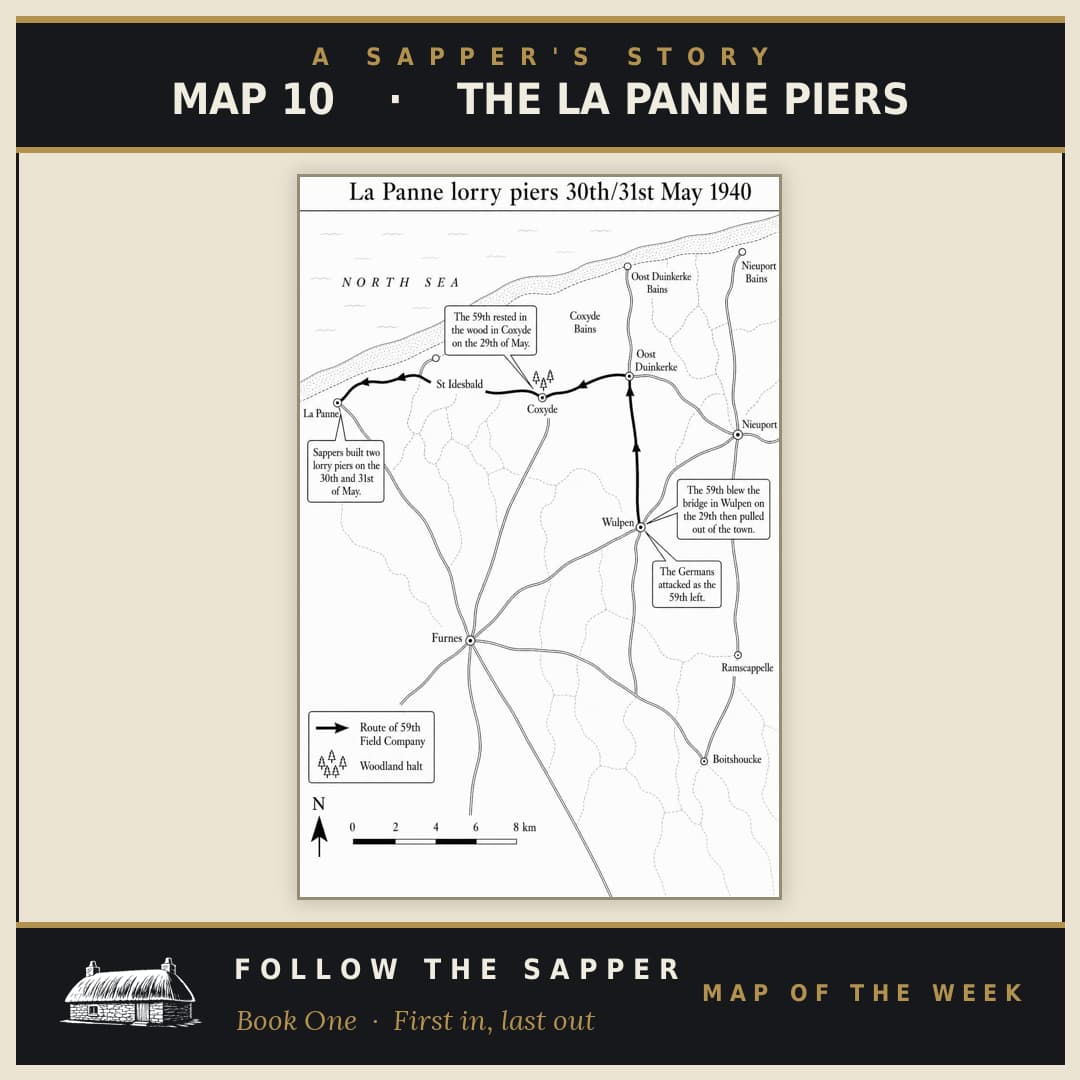
The La Panne Piers
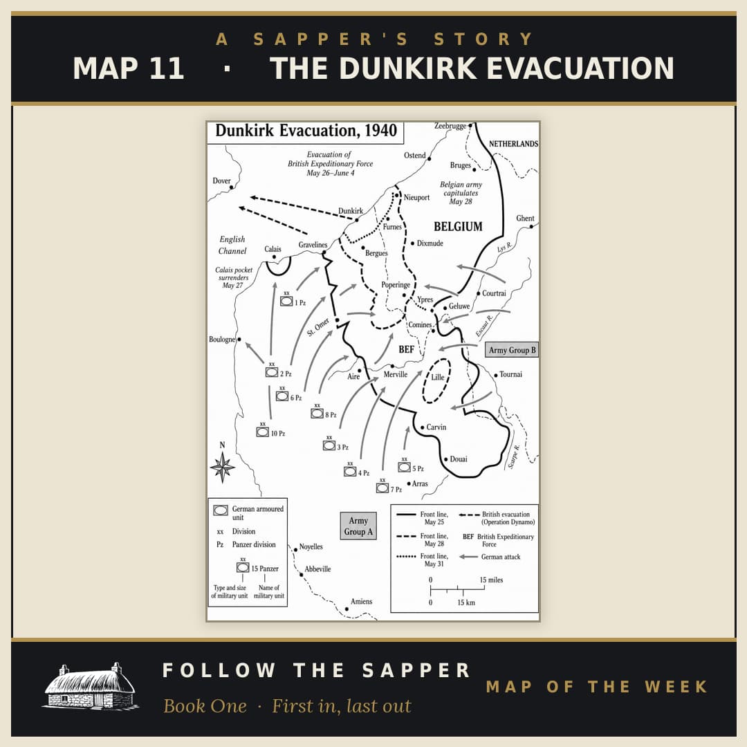
The Dunkirk Evacuation